Zareen 3D Surveys specializes in industrial plant modeling and land surveying services.
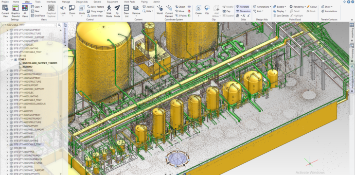
We specialize in creating intelligent 3D models for various industrial plants, including oil and gas, chemical, nuclear, metal, and fertilizer plants. Our services include generating isometric drawings, producing P&ID and spec productions, tagging, line listing, creating support and instrument drawings. We also offer scanning, point cloud registration and classification services.
In addition, we are proficient in land surveying, which is
Route Surveys: Powerline, Railway track, Canals, Roads, Tunnel, Water & oil-Gas Pipeline Surveys. We can prepare profiles, layouts, shop drawings & sections.
Building Surveys: Marking, Setting out, 2D & 3D Plans, Sections, All Side Views, Elevation, . We follow societal & international rules. We will do the quantity for you, such as Block and brick’s nos, Electrical wires quantity & price,
Mechanical & plumbing nos & expense, Steel/Structure quantity & price, Concrete ratio, quantity, and class with price.
Topographic/Mapping Surveys:
Extensive area mapping with 3mm accuracy by using UAV
Huge control point network with concrete block & pin
raverse/control calculation by Paid software
Ground & Vegetation model, DTM (Digital Terrain Model), DSM (Digital Surface Model) & CHM (Canopy Height Model).
3D Lines Surveys: Are ideal for creating 3D models on Google Earth or maps. Many platforms can perform this task, but “Sensat” is known for its high accuracy, navigation, and quality. To create a 3D Lines survey, a geo-referenced point cloud must be captured through a scanner.
As Built Surveys: On the other hand, capture the details of complex buildings or industrial plants. Our instruments can capture 360-degree images and HD videos, creating a fully intelligent model that includes all the necessary details.
The primary use of As Built Surveys is for relocation services on a large scale. We can capture the required data on-site, create a model on the computer, and relocate it accurately.
Hydrographic Survey: Lastly, Hydrographic Surveys are used to measure underwater areas’ depth and physical features. These surveys are typically divided into Harbour, Passage, Coastal, and General Hydrographic surveys. We offer various services, including mapmaking, mining, construction, quantity surveying, and precision surveys. You can trust us to provide accurate and reliable data for your projects


